Portable Avionics in a Wrist-worn Package
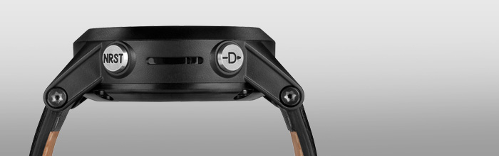
- Has Direct-to and Nearest buttons that use a worldwide airport database
- Altimeter with adjustable baro setting and compass
- Displays multiple time zones with Zulu/UTC reference
- Various timers and vibrating alerts for inflight task reminders
- Wirelessly receives flight plan from Garmin Pilot and controls VIRB
The D2 is a pilot watch designed to be as sophisticated
in style as it is in function. It’s the first pilot watch to help you
in-flight, boasting a high-sensitivity WAAS GPS receiver, altimeter with
adjustable baro setting, and 3-axis compass. It has a domed lens to
make the screen easy to read in direct sunlight, and a brilliant orange
backlight for night flights.
Fly Direct-to or Nearest When You Need It
With D2, you can access our signature Direct-to and Nearest routing
with a simple press of a button. D2 has a worldwide airport database so
you can fly straight to the airport or waypoint of your choice. Or you
can find the nearest airport if you need to land quickly. You can view
your route on a moving map display, or follow the HSI to your
destination. By setting your own waypoints, you can also easily navigate
to any location not included in the database. You can even create Mark
on Target waypoints so you can easily reference locations you fly over.
Customizable Displays & Timers
The D2 has customizable displays so you can quickly access the data
that's most important to you, including current GPS ground speed, GPS
track, distance from waypoints/airports, estimated time enroute,
bearing, and glide ratio.
D2 shows you local time and Zulu/UTC time, along with up to 4
different time zones. Enable the stopwatch when you land to keep tabs on
your “time off,” and set timers with vibrating alerts to remind you of
important tasks, like switching fuel tanks.
Receive Flight Plans from Garmin Pilot
Conveniently build flight plans and create waypoints with
Garmin Pilot
on your compatible Bluetooth (BLE) device and easily upload them to D2.
Press a few buttons, and you’ll be able to navigate from
waypoint-to-waypoint all the way to your destination.
Control VIRB® Action Cameras
VIRB can capture your
flights in stunning HD quality. With a VIRB on your aircraft, you can
use D2 to wirelessly start and stop recording, view elapsed time, or
tell it when to capture still shots. D2 can even control multiple VIRB
Elite cameras at the same time, so you can capture the action from
multiple angles.
*GPS receiver has a nominal operating velocity range of 0 – 800 kts (411 m/s).
Physical & Performance
|
| Physical dimensions |
1.9" x 1.9" x .7" (4.9 x 4.9 x 1.7 cm)
|
| Display size, WxH |
1.2" (3.1 cm) diameter
|
| Display resolution, WxH |
70 x 70 pixels; transflective, monochrome, negative mode LCD
|
| Color display |
|
| Weight |
2.9 oz. (82 g)
|
| Battery |
Rechargeable lithium-ion
|
| Battery life |
Up to 50 hours (GPS mode); 2 weeks (sensor mode); 5 weeks (watch mode)
|
| Water rating |
5 ATM |
| GPS-enabled |
|
| High-sensitivity receiver |
|
| Barometric altimeter |
|
| Electronic compass |
|
| Smart notifications (displays email, text and other alerts when paired with your compatible phone) |
|
| Vibration alert |
|
| Watch functions |
Time, date, alarm, timer, chronograph, chimes and vibration
|
Maps & Memory
|
| Built-in memory |
20 MB
|
| Waypoints/favorites/locations |
1000
|
| Routes |
50
|
| Track log |
10,000 points, 100 saved tracks
|
Running Features
|
| Running dynamics |
|
| Accelerometer (calculates distance for indoor workouts, without need for a foot pod) |
|
Cycling Features
|
| Compatible with Vector™ |
|
| Bike speed/cadence sensor |
|
Performance Features
|
| Heart rate monitor |
Yes (optional) |
| Virtual Partner® (train against a digital person) |
|
| Auto Pause® (pauses and resumes timer based on speed) |
|
| Multi-sport (changes sport mode with a press of a button) |
|
| Advanced workouts (create custom, goal-oriented workouts) |
|
| Pace alert (triggers alarm if you vary from preset pace) |
|
| Interval training (set up exercise and rest intervals) |
|
| Heart rate-based calorie computation |
|
| Calculates calories burned |
|
| Training Effect (measures impact of an activity on your aerobic fitness) |
|
Outdoor Features
|
| Hunt/fish calendar |
|
| Sun and moon information |
|
| Area calculation |
|
| Jumpmaster |
|
Avionics Features
|
| Worldwide airport database(s) |
|
| Altimeter with adjustable baro setting |
|
| 3-axis compass with HSI |
|
| Multiple time zones with Zulu/UTC |
|
| Wirelessly receive flight plans from Garmin Pilot™ |
|
Garmin Connect™
|
| Garmin Connect™ compatible (online community where you analyze, categorize and share data) |
|
Additional
|
| Additional |
GPS receiver has a nominal operating velocity range of 0 – 800 kts (411 m/s) |


0 Comments